


Year 5 Geography Curriculum
Children will be taught three key strands of geographical knowledge, consider the subject’s relevance to our chosen Modern Foreign Language (Spanish) and a selection of necessary skills to become geographers. Pupils will be encouraged to interpret and navigate a variety of maps, in physical and digital forms, as well as drawing many of their own with suitable symbols and scale. They will be taught…
An Area of Human Geography: Features of Britain
- To name and locate cities of Britain, considering their expansion and city layout.
- To identify regions and counties and their human characteristics.
- About types of settlement in Britain and how land is used.
- To locate key cities in Britain and highlight their land-use patterns.
- To discuss how settlements have changed over time and why.
Two areas of Physical Geography: Rivers, Coasts and Features of Britain
- To name and locate counties of Britain, identifying their physical characteristics.
- To highlight the key topographical features (hills, mountains, valleys, coasts, rivers) of cities for settlement.
- To discuss how topographical features may have changed over time in cities.
- To describe and understand river formation, vocabulary and flow.
- To name features of a coastline and river.
- To describe and understand coastal formation, erosion and weathering.
- To explain how erosion changes rock.
A range of Geographical skills: Map Reading, Map Making & Fieldwork
- To use thematic maps for specific purposes.
- To use simple grids and give directional instructions up to 8 cardinal points.
- To use six-figure coordinates to locate features.
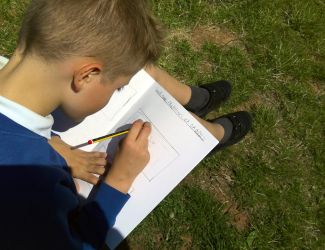
- To devise a scale map of a local river and coastline, including key features and landmarks.
- To use digital maps to illustrate a story or issue.
- Use fieldwork and observational skills to measure, record and present physical and human features of nearby river and coastline, including a range of methods: sketch maps, plans, graphs and digital technologies.
- To consider the importance of qualitative and quantitative data through a river study, from source to mouth.
- To understand data collection and graph creation to demonstrate river changes.
MFL Links: Spanish Coasts & Rivers
- To explore key Spanish rivers and how they compare to a local study.
- To consider the features of the Spanish coastline, drawing comparisons and differences with Britain.