English
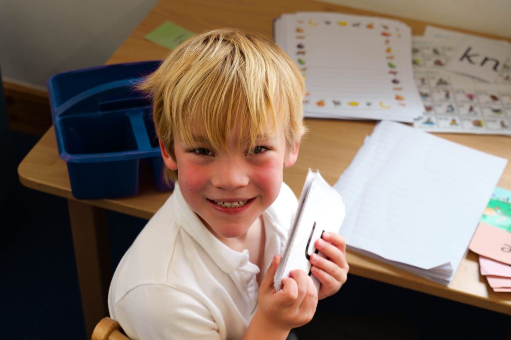
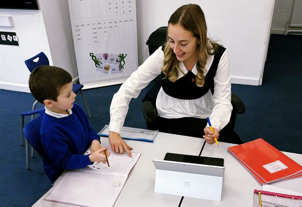
Our vision— Every Child a Reader — drives a curriculum that nurtures confident readers, imaginative storytellers, and purposeful writers. In the Early Years and Key Stage 1, we build strong foundations in language through Read Write Inc. Phonics, alongside clear letter formation. These early skills support fluency, comprehension, and a lifelong love of reading.
As children progress, they continue to develop accuracy and independence through Read Write Inc. Spelling from Year 2 onwards. High-quality texts inspire them to read widely and write for a range of real-world purposes—whether crafting persuasive arguments, telling stories, or sharing ideas. Through a rich, language-driven environment, we promote the belief that quality reading leads to quality writing, empowering every child to find their voice and use it with confidence and purpose.
Nursery
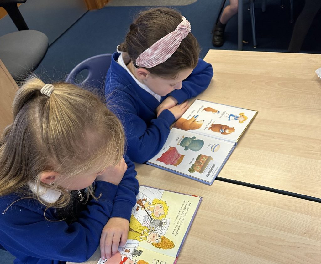
In Nursery, children begin their literacy journey in a vibrant, language-rich environment where stories, songs, rhymes, and conversations are part of everyday life. Each week, our learning is centred around a carefully chosen key text which provide meaningful contexts for children to explore language, build vocabulary, and develop a love of books.
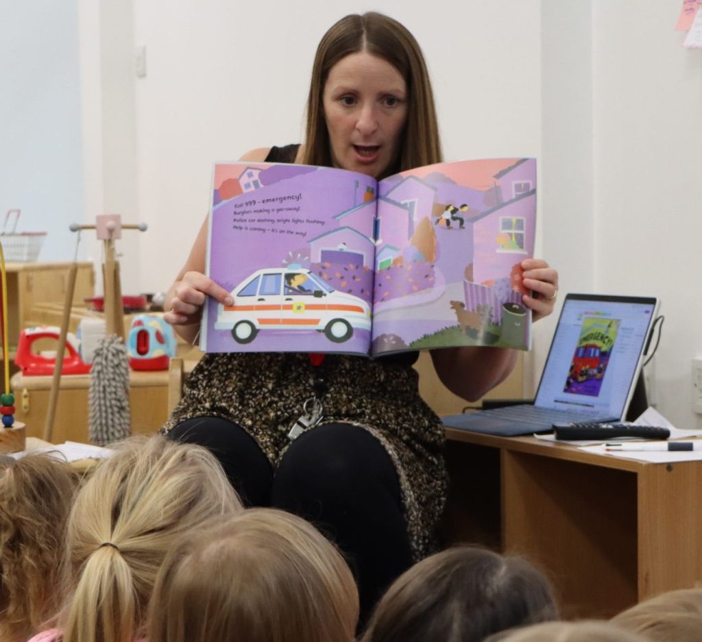
Children enjoy listening to and joining in with engaging stories like Elmer by David McKee, Ruby’s Worry by Tom Percival and Emergency! by Margaret Mayo. These books spark curiosity, encourage discussion, and inspire imaginative play. Children begin to talk about characters and events, predict what might happen next, and retell stories in their own words.
Alongside story time, children take part in early phonics activities, exploring sounds through rhymes, songs, and games. They begin to recognise their own names, understand that print carries meaning, and experiment with mark-making and drawing to express their ideas. These early experiences lay the foundations for confident communication, reading, and writing as they move through the Early Years.
Literacy
It is crucial for children to develop a life-long love of reading. Reading consists of two dimensions: language comprehension and word reading. Language comprehension (necessary for both reading and writing) starts from birth. It only develops when adults talk with children about the world around them and the books (stories and non-fiction) they read with them, and enjoy rhymes, poems and songs together. Skilled word reading, taught later, involves both the speedy working out of the pronunciation of unfamiliar printed words (decoding) and the speedy recognition of familiar printed words. Writing involves transcription (spelling and handwriting) and composition (articulating ideas and structuring them in speech, before writing).
It is crucial for children to develop a life-long love of reading. Reading consists of two dimensions: language comprehension and word reading. Language comprehension (necessary for both reading and writing) starts from birth. It only develops when adults talk with children about the world around them and the books (stories and non-fiction) they read with them, and enjoy rhymes, poems and songs together. Skilled word reading, taught later, involves both the speedy working out of the pronunciation of unfamiliar printed words (decoding) and the speedy recognition of familiar printed words. Writing involves transcription (spelling and handwriting) and composition (articulating ideas and structuring them in speech, before writing).
Reception
In Reception, children continue to thrive in a language rich environment where books, storytelling, and purposeful talk are central to their learning. Carefully chosen, high quality texts are used not only to develop early reading and writing skills but also to provide meaningful context for wider learning across the curriculum.
Children take part in daily phonics sessions using the Read Write Inc. programme, where they learn to recognise sounds, blend them into words, and read and write simple sentences with growing confidence. Alongside this, they enjoy a wide range of stories, poems, and non-fiction texts, including favourites like The Tiger Who Came to Tea by Judith Kerr, The Tiny Seed by Eric Carle, and Farmer Duck by Martin Waddell. These texts are used as springboards for learning, sparking discussions, inspiring role play, and linking directly to topics in science, understanding the world, and expressive arts.
In writing, children learn to form letters correctly and begin to write words and sentences independently. They write for a variety of purposes, such as shopping lists, story maps, labels, and short narratives—often inspired by the books they read and their own real-life experiences. These early literacy experiences help children make meaningful connections across areas of learning, laying a strong foundation for confident communication, reading, and writing as they move into Key Stage 1.
Literacy
It is crucial for children to develop a life-long love of reading. Reading consists of two dimensions: language comprehension and word reading. Language comprehension (necessary for both reading and writing) starts from birth. It only develops when adults talk with children about the world around them and the books (stories and non-fiction) they read with them, and enjoy rhymes, poems and songs together. Skilled word reading, taught later, involves both the speedy working out of the pronunciation of unfamiliar printed words (decoding) and the speedy recognition of familiar printed words. Writing involves transcription (spelling and handwriting) and composition (articulating ideas and structuring them in speech, before writing).
Year 1
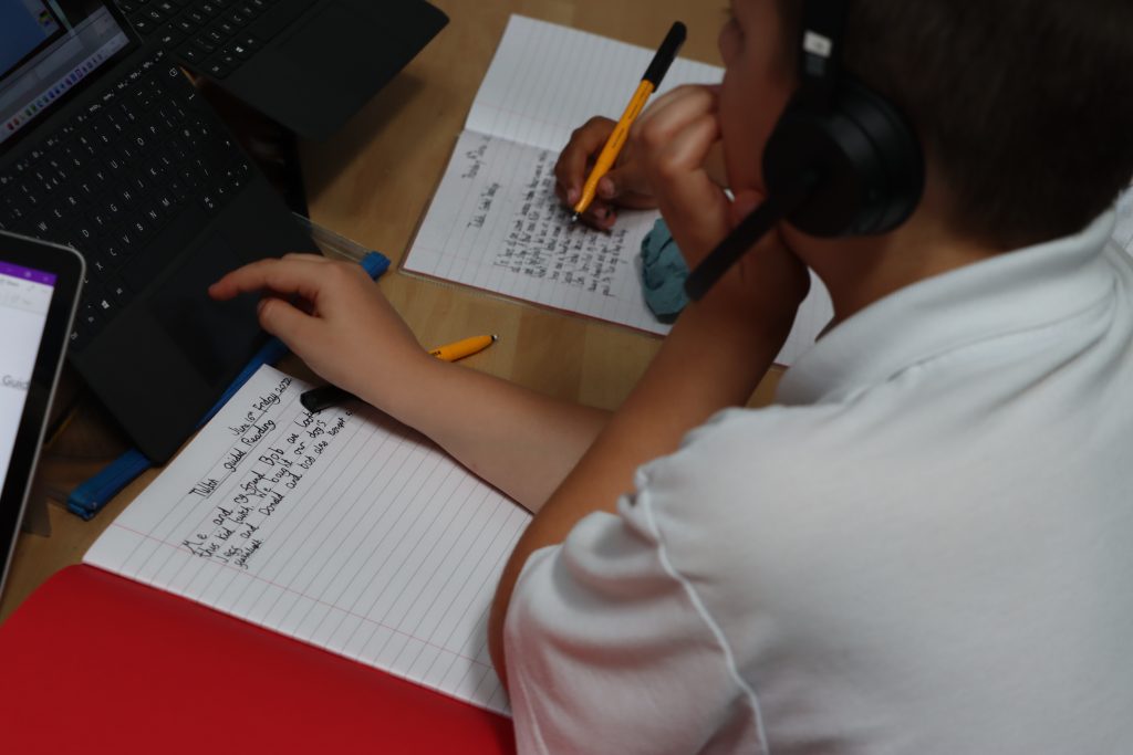
In Year 1, children build on their early literacy foundations through the Read Write Inc. (RWI) Phonics programme, which provides a structured and engaging approach to reading and writing. Daily phonics lessons are tailored to each child’s progress, helping them become fluent readers and confident writers. As their skills develop, children begin to write for a range of purposes, both fiction and non-fiction. Through exciting projects such as writing a sea explorer’s diary and sending persuasive letters to Greenpeace, they learn that writing can be used to tell stories, share ideas, and make a difference. Year 1 nurtures creativity, independence, and a growing understanding of how language works, setting the stage for future success in English.
Spoken Language
- Listen and respond appropriately to adults and peers.
- Ask relevant questions to extend understanding.
- Participate in discussions, presentations, performances, role play, and debates.
- Speak audibly and fluently with an increasing command of Standard English.
- Use spoken language to develop understanding through imagining and exploring ideas.
Reading – Word Recognition
- Apply phonic knowledge and skills as the route to decode words.
- Respond speedily with the correct sound to graphemes (letters or groups of letters).
- Read common exception words and words with contractions.
- Read aloud accurately books that match their phonic knowledge.
Reading – Comprehension
- Develop pleasure in reading, motivation to read, vocabulary and understanding by:
- Listening to and discussing a wide range of poems, stories, and non-fiction.
- Becoming familiar with key stories, fairy stories, and traditional tales.
- Recognising and joining in with predictable phrases.
- Understand both the books they can already read accurately and those they listen to.
- Discuss word meanings, linking new meanings to those already known.
Writing – Transcription
- Spell words using phonics as well as common exception words.
- Name the letters of the alphabet in order.
- Use letter names to distinguish between alternative spellings.
- Sit correctly at a table, holding a pencil comfortably and correctly.
- Begin to form lower-case letters in the correct direction, starting and finishing in the right place. Form capital letters and digits 0–9.
Writing – Composition
- Say out loud what they are going to write about.
- Compose a sentence orally before writing it.
- Sequence sentences to form short narratives.
- Re-read what they have written to check it makes sense.
- Discuss what they have written with the teacher or other pupils.
- Read aloud their writing clearly enough to be heard by peers and adults.
Writing – Vocabulary, Grammar and Punctuation
- Leave spaces between words.
- Join words and clauses using “and”.
- Begin to use capital letters, full stops, question marks and exclamation marks.
- Use capital letters for names and the personal pronoun “I”.
- Understand regular plural noun suffixes (-s, -es) and the prefix un-.
- Begin to use grammatical terminology in discussing their writing and reading (e.g. noun, verb, adjective).
Year 2
Year 2 is a year of growing confidence and creativity in writing. Children explore a wide range of writing styles and purposes, including descriptive writing, diary entries, letters, interviews, writing in role, narratives, menus, persuasive texts, book reviews, recounts, and poetry. These varied opportunities help children understand how writing can be used to express thoughts, share experiences, and influence others. Writing continues to be supported through the Read Write Inc. phonics and spelling programme, which strengthens their grasp of spelling, grammar, and sentence structure. As their independence grows, children begin to take more ownership of their ideas, developing clarity and imagination in their written work. Year 2 lays the foundation for children to see themselves as authors, using language to communicate with purpose and flair.
Spoken Language
- Continue to develop speaking and listening skills through discussions, presentations, and role play.
- Ask and answer questions to deepen understanding.
- Use spoken language to explore and clarify ideas.
- Speak audibly and fluently with increasing confidence.
Reading – Word Recognition
- Apply phonic knowledge and skills to decode words.
- Read accurately by blending sounds and recognising common exception words.
- Read words containing common suffixes.
- Read aloud books matched to their phonic ability with increasing fluency.
Reading – Comprehension
- Develop pleasure in reading and understanding of texts by:
- Listening to and discussing a wide range of stories, poems, and non-fiction.
- Becoming familiar with key stories and traditional tales.
- Recognising recurring literary language.
- Discuss the sequence of events in books and how information is related.
- Make predictions and inferences based on what is read.
- Explain and discuss understanding of texts.
Writing – Transcription
- Spell words using phonics and common exception words.
- Learn to spell using suffixes and rules for adding them.
- Use apostrophes for contractions and possession.
- Form lower-case letters of the correct size relative to one another.
- Use spacing between words that reflects the size of the letters.
Writing – Composition
- Develop positive attitudes towards writing by:
- Writing narratives about personal experiences and those of others.
- Writing for real purposes, including letters, reports, and instructions.
- Plan and discuss ideas before writing.
- Re-read and evaluate writing for sense and effectiveness.
- Proofread for spelling, grammar, and punctuation errors.
Writing – Vocabulary, Grammar and Punctuation
- Use expanded noun phrases to describe and specify.
- Use present and past tense correctly and consistently.
- Use subordination (e.g. when, if, that, because) and coordination (e.g. or, and, but).
- Use capital letters, full stops, question marks, and exclamation marks correctly.
- Begin to use commas in lists and apostrophes for possession.
- Use and understand grammatical terminology in discussing writing (e.g. verb, tense, adjective, noun).
Year 3
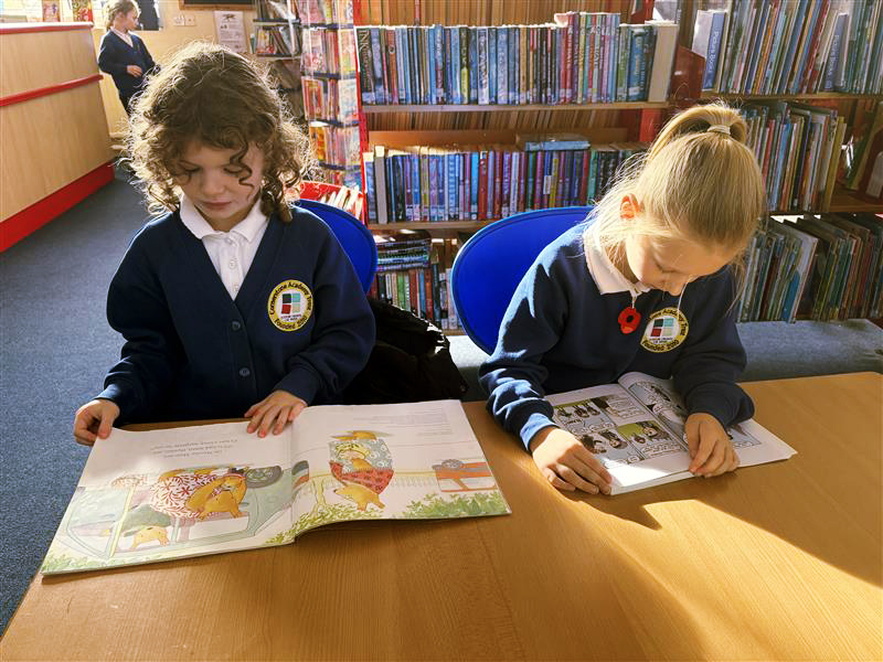
In Year 3, children grow as independent writers, exploring a variety of exciting opportunities to express their ideas. They develop storytelling skills through National and Trust-wide 500-word competitions, while also becoming confident in non-fiction writing, creating leaflets, posters, and other purposeful texts. A strong focus on handwriting ensures their growing ideas are presented clearly and consistently. Grammar is taught in meaningful contexts, helping children craft more precise and effective sentences. Reading continues to underpin all writing, with children using Accelerated Reader independently to choose books that match their level and interests, both at school and at home. This supports vocabulary development and fuels their creativity. Children also begin to explore script writing and podcast creation, blending traditional literacy with digital communication. Year 3 is a pivotal year where writing becomes a powerful tool for expression, imagination, and real-world communication.
Spoken Language
- Participate actively in discussions, presentations, and performances.
- Use spoken language to develop understanding and express ideas clearly.
- Begin to adapt speech for different purposes and audiences.
Reading – Word Recognition
- Apply growing knowledge of root words, prefixes, and suffixes.
- Read a wide range of fiction, poetry, plays, and non-fiction.
- Develop inference skills and justify views with evidence.
- Identify themes and conventions in texts.
Writing – Transcription
- Use further prefixes and suffixes and understand spelling rules.
- Spell homophones and commonly misspelled words.
- Increase legibility and consistency in handwriting.
Writing – Composition
- Plan writing by discussing structure, vocabulary, and grammar.
- Draft and write narratives and non-fiction using organisational devices.
- Evaluate and edit writing for clarity and effectiveness.
Writing – Grammar and Punctuation
- Use a range of conjunctions, adverbs, and prepositions.
- Use inverted commas to punctuate direct speech.
- Understand and use grammatical terminology (e.g. clause, conjunction).
Year 4
In Year 4, children continue to grow as confident and independent writers, while also developing collaborative skills through group work and speaking and listening activities. They build on their storytelling abilities through the ongoing 500-word competitions, crafting imaginative adventure stories that showcase their creativity. Writing is rich and varied, with a strong focus on content and purpose, including non-fiction texts such as leaflets, posters, and reports, often linked to Humanities learning. In the spring term, children write and perform their own Horrible Histories scripts, blending historical knowledge with humour and performance. The Accelerated Reader programme continues to support reading for pleasure and comprehension, enriching vocabulary and deepening understanding of structure and style. Year 4 is a dynamic year where writing becomes a collaborative, expressive, and purposeful tool—whether children are informing, entertaining, or persuading their audience.
Spoken Language
- Use spoken language to explore ideas and participate in role play.
- Speak clearly and confidently in a range of contexts.
Reading – Word Recognition
- Read aloud with fluency and expression.
- Discuss words and phrases that capture interest.
- Summarise main ideas and identify how language contributes to meaning.
Writing – Transcription
- Consolidate use of prefixes, suffixes, and spelling patterns.
- Use joined handwriting consistently.
Writing – Composition
- Organise paragraphs around a theme.
- Create settings, characters, and plot in narratives.
- Use a range of sentence structures and vocabulary.
Writing – Grammar and Punctuation
- Use fronted adverbials and commas after them.
- Use apostrophes for plural possession.
- Expand noun phrases and use standard English forms.
Year 5
In Year 5, writing is all about depth and purpose. Children continue to explore familiar formats such as leaflets, reports, creative writing, and poetry, but with a focus on refining quality and improving writing pace. This year emphasises the application of writing, linking English closely with the performing arts. High-quality texts are used to inspire their own Cautionary Tales, helping children understand tone, structure, and style before writing and performing their own versions in a local theatre. They also create scripts for historical re-enactments at local heritage sites, bringing history to life through powerful storytelling. Throughout the year, writing becomes a tool for expression, performance, and real-world communication, as children deepen their skills and write with greater intention, audience awareness, and creativity.
Spoken Language
- Articulate and justify opinions.
- Use spoken language to hypothesise and explore ideas.
Reading – Word Recognition
- Read and discuss a broad range of texts including myths, legends, and modern fiction.
- Distinguish between fact and opinion.
- Retrieve, record, and present information from non-fiction.
Writing – Transcription
- Use a wide range of spelling strategies and rules.
- Maintain legible, fluent handwriting.
Writing – Composition
- Plan, draft, and evaluate writing with a clear sense of audience and purpose.
- Use dialogue to advance action and develop characters.
- Use cohesive devices within and across paragraphs.
Writing – Grammar and Punctuation
- Use relative clauses, modal verbs, and adverbs.
- Use brackets, dashes, or commas for parenthesis.
- Use commas to clarify meaning or avoid ambiguity.
Year 6
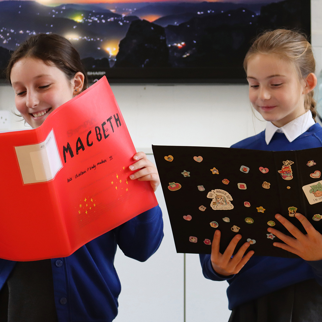
In Year 6, writing is all about showcasing personal style and developing a strong individual voice, while also learning to adopt the perspectives of others. Children explore this through powerful pieces such as diary writing in the style of Anne Frank, following their visit to the Netherlands. Much of the English curriculum is centred around the Global Communities Project, where children apply their skills to real-world contexts—creating marketing campaigns, pitching ideas using PowerPoint, and producing detailed business reports. Alongside these practical applications, children are encouraged to be creative authors, crafting inspiring and imaginative tales from scratch. Year 6 is a culmination of their writing journey, where expression, purpose, and authentic voice come together to prepare them for the next stage of learning.
Spoken Language
- Use spoken language effectively for debate, discussion, and presentation.
- Reflect on and evaluate spoken contributions.
Reading – Word Recognition & Comprehension
- Read a wide range of challenging texts fluently.
- Analyse how language, structure, and presentation contribute to meaning.
- Make comparisons across books and justify interpretations.
Writing – Transcription
- Use a range of spelling strategies, including etymology and morphology.
- Write legibly, fluently, and with increasing speed.
Writing – Composition
- Write effectively for a range of purposes and audiences.
- Use a wide range of devices to build cohesion.
- Evaluate and edit to enhance impact and clarity.
Writing – Grammar and Punctuation
- Use the passive voice and subjunctive form where appropriate.
- Use semi-colons, colons, and dashes to mark boundaries.
- Use hyphens to avoid ambiguity and punctuate bullet points consistently.
Address
Contact
Contact: admin@tcat.education
Phone: 01392 304040
© The Cornerstone Academy Trust 2025